Client platform
Dragonfly GeoAnalytics
A geointelligence platform that helps municipalities fight dengue, Zika and chikungunya with drone imagery and case mapping.
Dragonflies prey on mosquito larvae; Dragonfly maps breeding sites and disease cases from drone flights so that health teams can see outbreaks as they move. I built the whole ecosystem for a Brazilian engineering company: frontend, two backends, tile server and the GitOps deployment.
At a glance
- React frontend with Mapbox (react-map-gl), Highcharts dashboards and a dark-mode Chakra UI
- Data API in Express and Prisma; authentication service in Django REST Framework with OAuth2
- PostGIS with pg_tileserv serving vector tiles (MVT) directly from the database
- Deployed for several municipalities through a GitOps pipeline on Docker Swarm with Portainer
The system
Field teams fly drones over neighbourhoods; the platform georeferences potential breeding sites and confirmed cases, aggregates them over time and space, and presents statistics and trends per district. The frontend renders vector tiles served straight from PostGIS through pg_tileserv, which kept the backend small and the maps fast.
I split the backend in two on purpose: a typed data API in Express and Prisma for speed of iteration, and a Django REST Framework service with Django OAuth Toolkit for a robust, standards-based authentication system. A separate mobile module was built as its own project.
Delivery
The contract covered design, development, the data-collection methodology and cloud deployment. Everything is containerised and rolled out through an infrastructure-as-code pipeline, so a new municipality is a configuration change rather than a new build.
More projects
All projects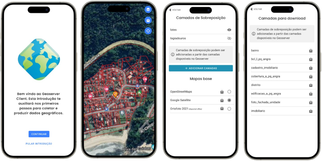
GeoServer Mobile Client
An offline-capable mobile client for GeoServer layers: download, view, edit features and export, built in three weeks.
- Ionic
- React
- TypeScript
- OpenLayers
- +2
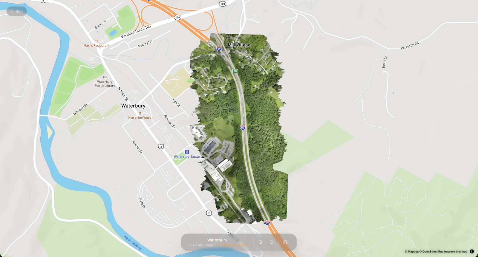
Territorial Maps
A SaaS for publishing drone imagery: upload from your computer, get web-ready layers and share instructions for any GIS.
- Next.js
- MapLibre
- Cloudflare
- n8n
- +3
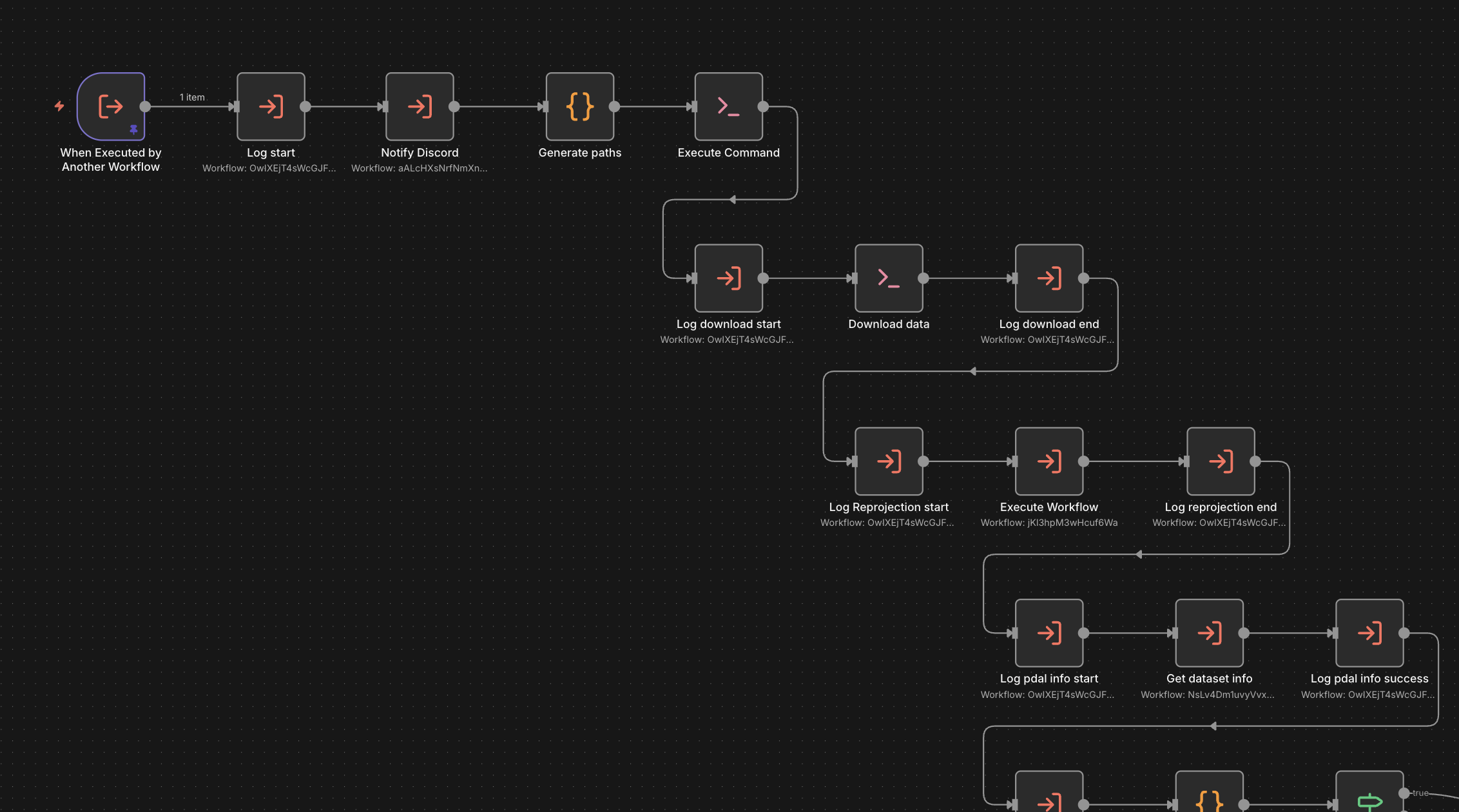
Point Cloud Publishing Automation
An n8n-based framework that takes raw point clouds to optimised Potree scenes, built as the backend of a SaaS.
- n8n
- PDAL
- Entwine
- PotreeConverter
- +3